
Mount Cook National Park and Sealy Tarns

From Lake Tekapo to Lake Pukaki is only a short drive. There, a 60 km long dead-end street begins that ends up north in Mount Cook Village, named after the highest peak of the Southern Alps: is Aoraki/Mount Cook. The National Park of the same name offers some very nice walks, one of which leads up to the Sealy Tarns and – if you have enough time and energy – further on to the Mueller Hut where you can stay for the night.

Having arrived in the early afternoon, I pitched my tent and only went up to the tarns. You start at the valley floor at an altitude of about 750m. The trail then winds up the hill but remains an easy walk apart from the fact that you walk up all the time and that there are plenty of steps – someone wrote “Just 1810 steps left” on one of the first ones. While I didn’t count, they seemed endless. However, with each zig and every zag the views are getting better and better so that you just can’t stop and turn around back down. The view towards south-east shows the tiny village right above that big rock in the foreground while the campground can be seen right above the bush in the foreground at the left edge of the image. In the far distance is the Tasman River which feeds Lake Pukaki further down the valley.

A little further up, at an altitude of about 1200 meters, there is this beautiful view towards Mount Cook, at little more than 3700 meters the highest mountain of New Zealand. Right below lies the Hooker Glacier – barely identifiable as it is covered by a huge mass of rocks – with its terminal lake. Further towards the foreground is the huge lateral moraine of Mueller Glacier, whose terminal lake is in the foreground. All of the water has a greyish colour due to rock flour.
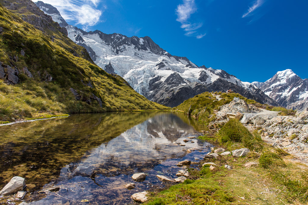
The final image of this trip shows the Sealy Tarns. In fact, I like and dislike this photo at the same time. It somehow captures what I wanted to capture and I really like the composition with its lines, the reflection of the tarn and the small hill on the right echoing the rock wall behind it. I also like the colours and the contrast they are producing and even the fact that there are some people in the photo (something I try to avoid most of the time), giving a sense of proportion.
However, the photo does not capture the dramatic scenery as you experience it when standing up there: Between the grassy slopes where I was standing and those rocks and snowfields in the background, there is a valley several hundred metres deep with a glacier and its terminal lake as you can see from the photo above. Then further on towards Mount Cook (which is several kilometres away) there is another rock wall plus another glacier with lake (as you can see in this photo). You just don’t get an idea of that with this image. I guess what I am trying to say is this: Go there and experience the landscape yourself; no photo can do it justice.
The last photograph was made with a Canon EOS 6D and an EF 24mm f/2.8 IS USM lens. The exposure was 1/160 second at f/8 and ISO 200. The other photos were taken with an EF 35mm f/2 IS USM. The photographs were edited in Adobe Lightroom. You can find these photos along with others from this journey across New Zealand’s South Island in my album New Zealand 2013 or on Flickr. The photo of the Sealy Tarns is also in my portfolio and is available as a limited edition print.